To begin with, it is necessary to look at the the map of Hocking State Forest. As you can see, Hocking State Forest is made up of many non-contiguous parcels. Hocking Hills State Park consists of four different areas (Cantwell Cliffs, Rock House, Ash Cave, and Old Man's Cave to Cedar Falls). There are also three State Nature Preserves within the State Forest. To access the rest of the State Forest I use the Bridle Trails, which are also open for hikers. Having said that, the first two Hidden Hollows are actually still in the State Park.
The simple explanation of where these hollows are located is this: Walk west along Queer Creek from Cedar Falls. When the trail turns right towards Old Man's Cave turn left and cross the creek so that it is on your right. The two hollows will be on your left. That makes sense when looking at a map, but in reality you can't cross the creek there. And even if you do the bank on the other side is nearly vertical and doesn't seem to offer any way up the hillside. Find your own way across. Good luck when the creek is high. [Hint: Go to these hollows in the fall when you can cross the creek and climb out of them (more on this later) onto the Forest Road that is only a hundred feet or so from the top of the waterfall. Look for landmarks. There are actually kilometer and/or mile markers (that make no sense) that you can make a note of. Turn left and follow the road for two miles or less than two kilometers (I told you the markers make no sense) and it reaches the trail from Cedar Falls to Ash Cave. In the spring I park at Cedar Falls and follow to road to the Hidden Hollows and hike down into them from above.]
After reading that paragraph, you deserve a photo:
 |
| A well-deserved photo. |
That photo was taken at about the mid-point between Cedar Falls and the junction of Queer Creek and Old Man's Creek (you know, where you turn left to reach the Hidden Hollows that I am supposed to be telling you about, I'll get back there eventually). I call that place The Icebox because I first went there on a 65 degree day in April and there were huge ice blocks behind the slump blocks between the cliff and the slopes. It was about 20 degrees cooler there. Anyway, if you hike around the slump block on the right side of the photo there is an easy way out of the gorge.
 |
| An easy way out. |
That leads you up to the Forest Road as well. To get to this point requires some tough climbs and tight squeezes if you are wearing a backpack. Or you can hike down from above after you find your landmarks.
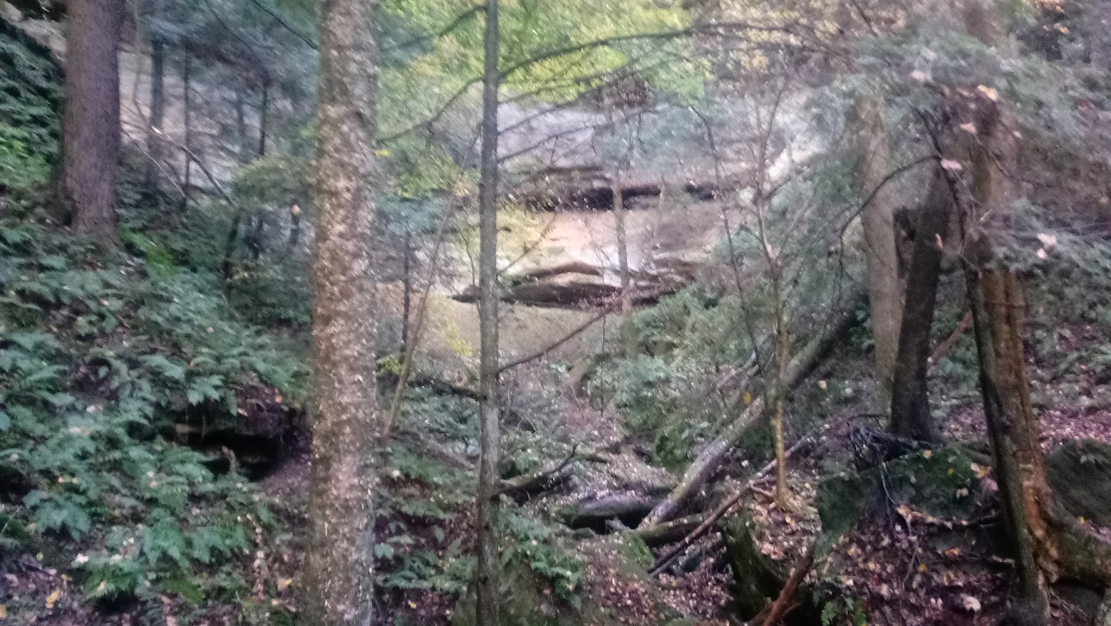
And now back to our regularly scheduled Hidden Hollows. I originally got to the first hollow by crossing Old Man's Creek and walking downstream with Salt Creek (created by the junction of Old Man's and Queer creeks) on my left and then crossing the creek when I saw the hollow. Every time I have done that I have gotten wet. Just one foot and some splashes on the legs. Fine in warm weather, not so when it's cold. That's why I started crossing Queer Creek before I got to Old Man's Creek, at a small hollow (in regards to the distance from its waterfall to the creek) known as Death of Doug Falls. That is a bit of a misnomer because I am the Doug it was named for and I am, unfortunately for the poor souls who have to read this, still alive. In fact, once I realized that the fall I took only resulted in a few bruises and scratches, it was kind of fun. This waterfall creates a huge cone in the winter, almost as big as the one at Ash Cave. It, like The Icebox, is just across the creek from the trail and doesn't qualify as "hidden" according to the rules that I just made up.
But enough digressions, by this point you have crossed Salt Creek and have climbed 30 to 40 feet above the creek and found a deer trail that provides a fairly level walking surface along the steep slope. You will have to climb 20 feet every so often to reach the next level-ish deer trail. If you look up slope and see a rock about to roll downhill and crush you, you are in the right spot.
 |
| A huge rock that is about to break free and crush hikers seeking hidden hollows. |
Go ahead and walk up hill and get a better look at this soon-to-be killer rolling stone. It is a great place to stop and take a break.
 |
| Looking up while laying on my back directly in the path of the Killer Rock. |
If you don't want to risk your life laying in the path of the Killer Rock (it's really not that dangerous, I'm just trying to add drama to an otherwise boring blog as well as justify the name of the hollow) there are many places to rest on the soft hemlock needles as the "trail" turns to the left and starts up Killer Rock Hollow. I like that name. It is even better than Death of Doug Falls. Even better than the name is the place. I will hike for hours without stopping more than 3 minutes, but here I will stop for a longer time, hike for five minutes and stop again. After all the work of getting here you might as well spend an hour or two enjoying it.
 |
| Almost to the waterfall in Killer Rock Hollow. |
 |
| A sample of a location that offers a way out of the gorge. |
Of course, this method of finding a way out doesn't work all the time. Sometimes the slump blocks (or chunks of rock or stone - whatever you or I want to call them) slide too far downhill and/or fail to catch enough sediment behind them to provide a way out. Great. Those areas are sometimes the most interesting places to explore. The Icebox described above is a grand example, but many smaller areas offer their own treasures to be found.
October 2017 update

Guilty as charged. If the names I have given the Hidden Hollows haven't scared you off, maybe this sign will. It (and its brother) are on the new Hemlock Bridge and Whispering Cave trails. Whispering Cave is really cool and has all the characteristics of a Hidden Hollow, except for the hidden part. And it has a trail leading to it with steps and safety rails. And the trail has other people on it, which is bad because I hate people (except for those who read my blog blog blog. Is there an echo in here? here? here?).
Anyway, I parked at the trailhead by the old lodge (they are still removing the remains from the December 2016 fire that destroyed it) and, after visiting Whispering Cave, headed down the Hemlock Bridge Trail to see where it met the other existing trails. I was not planning on a long hike, but the lure of Killer Rock Hollow and Unnamed Hollow nearly directly across Salt Creek could not be resisted. I was already wet and muddy from my earlier hike in Long Hollow so my one-splash crossing caused no further harm.
 |
| Beyond the fallen trees in the creek is a fallen log on the bank. The stream from the newly-named Rocky Run Hollow is near the right end of that log. |
 |
| Rocky Run Hollow was formed by this tiny stream. |
So, after digging my feet into the mud of fresh landslides and going over and under the fallen trees along the creek bank I finally got to the unnamed hollow (although at this time I thought this was Killer Rock Hollow). I hiked over a few small stones and around a couple sofa-size boulders expecting to see the stream leading to the base of a waterfall. What I saw instead was hundreds of sofa-sized, car-sized, and even truck-sized boulders with thousands of ottoman-sized and smaller (I'm struggling for comparisons) stones between them that kept the tiny little stream out of sight. The slopes were too steep to walk on so I had to walk up,over, around, and through (OK, not through) the boulders. It was the most fun I have ever had on a 1/10 mile hike.
 |
| Two big boulders at the bottom of the photo and one at the right. Climbing around and over many of these was the inspiration for the name Rocky Run Hollow. |
In the photo above (the least-horrible of my many efforts) you can see where the light between the trees stops. That is the rim of the hollow and it is only 60 feet above the base of the waterfall. At least it would be if there was a waterfall. There was one steady drip and a couple periodic drips along the wall - surprising since it had been raining for the previous two days. You can tell from the landing area (it could be called a splash pool but I doubt there is ever enough water there to splash) that even in wetter times there is not much water in this hollow, and definitely not the spectacular waterfall that I imagined when I saw this hollow from above a few years ago. This is when my suspicion was confirmed that I was not in Killer Rock Hollow.
Rocky Run Hollow is all about the journey and not the destination.
Killer Rock Hollow is both.

I tried in my earlier senseless ramblings to describe the difficulty of getting to Killer Rock Hollow from the trails of Hocking Hills State Park. Getting to Rocky Run Hollow was no walk in the park either (that was too easy not to use). Getting from one to the other is surprisingly easy. So, as long as you have decided on a life of crime (off trail hiking is illegal, I read that somewhere) you might as well visit both.
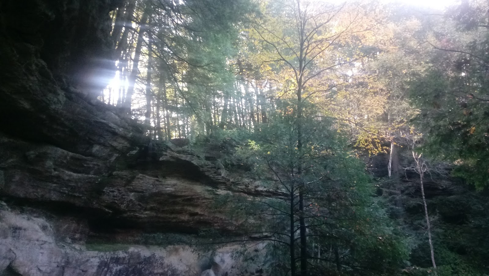
It is a fairly easy walk along the stream until you reach the point above. The waterfall shown two photos above is straight ahead. There is another large cliff face and seasonal waterfall to the left of this photo. Shown on the left side of the photo is a ridge separating the two. It is almost entirely covered in ferns. If I was the kind of guy who names everything I see I would call it the Pyramid of Ferns. It is kind of like the Gorge Trail at Conkle's Hollow (where the area to the left of the trail is a fern-covered slope) except that this is taller. Another difference is that, rather than viewing the beauty from a distance I hiked right up the middle, trying to avoid trampling the ferns. The rewards of that are shown below.
 |
| Standing amongst the ferns looking at the large waterfall on the right. In what is almost surely an accident, I somehow managed to center the "splash pool" (the dark spot) of the waterfall. |
 |
| If this seasonal waterfall was flowing it would be in the foreground slightly right-of-center. Notice that the area beyond this waterfall has significantly fewer ferns than in the photo above. |

 |
| The late afternoon sun shining into Killer Rock Hollow. |
 |
| I wrote before about how there is an easy way out hidden behind a slump block (in the spotlight on the left) that is near the top of the hollow. |
 |
| I turned around and realized that there was an even easier way out. I am forever humbled by the Hidden Hollows of Hocking Hills. |
Burgoon Hollow
This hollow has a series of really cool waterfalls near the beginning of the hollow that I quite literally stumbled upon. When I first "discovered" it I had started the day hiking at Conkles Hollow. I hopped onto the Orange Bridle Trail off of the East Rim Trail near the Upper Falls. I crossed SR 374 (Point K on the Bridle Trails Map) and followed it as it crossed the same power line and pipeline rights-of-way several times each, skirting huge horse mud pits along the way. Eventually I got to a sign (with a trail map) where the trail crosses a state forest road. Later I learned that this is Point J and is marked by a star and the words "Trail Information", leading me to initially call the hollow I found T.I. Hollow, although I don't think the rapper T.I. possesses much trail info. Anyway, since I have previously posted that following bridle trails is the key to finding Hidden Hollows, I obviously abandoned the bridle trail and followed the state forest road. After about five minutes of walking I came to a road on the left that required a 170 degree turn. It was too sharp of a turn to be called a fork, but it was less traveled so I took it.
More ramblings and bad photos coming soon.
This page will be continually updated as time allows and new hikes require. I will continually procrastinate and never finish this page. There's a bit of truth in both of those statements.
No comments:
Post a Comment